Our friends, the Unique Mappers Network of Nigeria, are hosting their State of the Map: Nigeria Conference from October 11-14. Consider attending in-person in Nigeria or online. We have published this post to celebrate their work! They contributed more to these projects than any other volunteer group. SciStarter is proud to support the conference as a travel grant sponsor.
Participants from around the world can map environmental problems with the Land Loss Lookout and Land Pollution Lookout projects. Land Loss Lookout invites volunteers to classify wetland loss in Louisiana, and Land Pollution Lookout focuses on oil spills in Nigeria.
Since 2020, over 100 dedicated volunteers, as documented in the SciStarter credit form for the project, have meticulously mapped in excess of 15,000 images of the Gulf Coast via Land Loss Lookout. Impressively, this effort led to the identification of 19 oil spills in Mississippi following Hurricane Ida.
In April 2022, the companion project, Land Pollution Lookout, was launched, and it has seen significant progress. Over 300 passionate volunteers have actively participated, mapping more than 1,500 images in the environmentally sensitive Niger Delta region, as reported via the project’s SciStarter credit form.
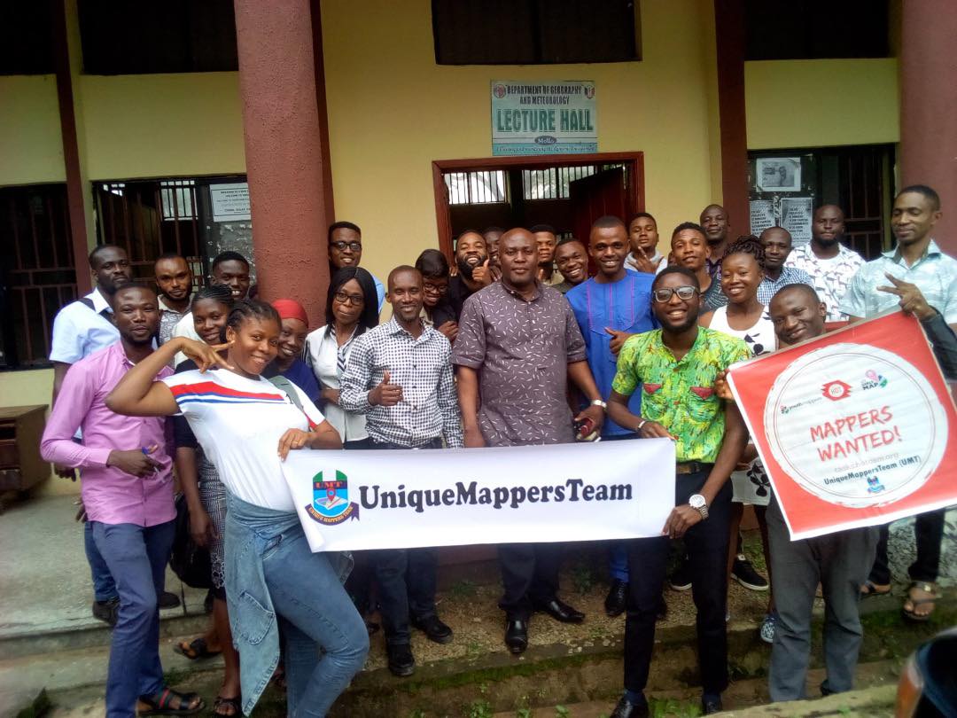
With both projects, the Unique Mappers Network of Nigeria has led the way in terms of volunteerism, energy, and drive to make a positive difference. The Unique Mappers Network is a Nigerian-based citizen science nonprofit that has collaborated with SciStarter and Humanitarian OpenStreetMap Team (HOT) USA, engaging local communities of Citizen Science and OpenStreetMap Volunteers in Nigeria and beyond.
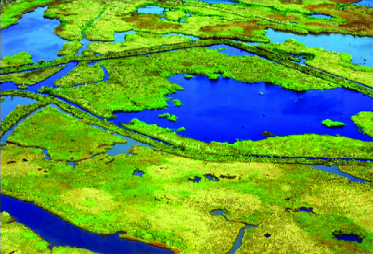
Land Loss Lookout: Tracking Land Loss on the Mississippi River Delta
Wetlands are being lost worldwide significantly due to rising sea levels caused by climate change. These are vital ecosystems that filter and purify water before it reaches the ocean or rivers, which is essential for maintaining clean water sources. They also act as essential environmental barriers, reducing damage from hurricanes by absorbing and slowing down the winds and water, protecting nearby communities.
Oil and gas extraction also contributes to the loss of wetlands. In the Gulf of Mexico, wetlands have been cut in half by many miles of oil and gas canals. These canals make it harder for the marshes to drain water properly, which leads to the wetlands disappearing more quickly.
As a result, we are not only losing precious ecosystems but also exposing ourselves to increased environmental risks and injustices. The loss of wetlands causes harm to important ecosystems, leads to unfair treatment of the environment, and makes storms more damaging to communities living alongside these wetlands.
What is Land Loss Lookout?
Developed by Cartoscope, a technology nonprofit, in partnership with Healthy Gulf, a nonprofit that serves the Gulf Coast of the United States, and Northeastern University, Land Loss Lookout is a citizen science project aimed at monitoring and documenting wetland loss on the Mississippi River Delta.
These groups came together around a shared love of citizen science and a shared goal to combat climate change. Caroline Nickerson, 2021 Miss Louisiana Earth in the Miss Earth USA 2021 pageant, focused on the project with her “Citizen Science Empowers Resiliency” platform, encouraging people worldwide to participate – including the Unique Mappers in Nigeria, who participated more than any other group.

Volunteers working with this project classify images of wetland loss to identify potential causes for the loss, including sea level rise, as well as oil and gas activity.
Land Pollution Lookout: Combating Oil Spills in the Niger Delta
After contributing to the Land Loss Lookout project, Cartoscope and Healthy Gulf collaborated with Unique Mappers Nigeria to create environmentally-focused citizen science projects benefiting Nigeria. Together, they launched Land Pollution Lookout in April 2022, engaging over 250 people in a week to assess oil spills in 3 protected areas of the Niger Delta.

The Niger Delta is a wetland located in southern Nigeria, where the Niger River empties into the Gulf of Guinea. The Delta is rich in oil and gas reserves, making it a significant hub for Nigeria’s oil industry.
In the Niger Delta, more than 900 oil spills have occurred in the last two years. Surprisingly, there hasn’t been a comprehensive study of their impacts yet. The Land Pollution Lookout project is dedicated to monitoring oil spills in this region, and the findings from this would play a crucial role in shaping regulations for this rapidly developing area.
By gathering information about oil spill locations, identifying oil pipelines, and documenting damage to vegetation, farmlands, rivers, and creeks, volunteers help to identify oil spill locations in the Niger Delta.
What’s Next?
These projects are all about teamwork, where AI and humans work together. AI helps with its speed and abilities, and humans use their thinking and teamwork. When sorting pictures, the platform will give AI-guided help and tutorials to make things fun and get better results.
The information from these projects will be shared with important groups to keep the environment and wetlands safe. Companies need to do things like turning off valves, cleaning up oil spills with crews, and paying fines if they do something wrong. They should also follow rules that protect coastal areas from big oil companies.
To make wetlands safer from climate change, we need to collect data that supports actions and rules. Our goal is to heal and bring back lost wetlands. The data we gather will help us create better policies and support for these changes.
Join the Land Loss Lookout and Land Pollution Lookout projects today via their SciStarter profiles.
A Heartfelt Thank You
We extend our deepest gratitude to the passionate volunteers who have dedicated their time, energy, and expertise to Land Loss Lookout and Land Pollution Lookout.
By actively participating in these projects, you are making a significant impact on our understanding of land loss and pollution. Your efforts inspire others and create a ripple effect that will help preserve our precious natural resources for generations to come!
Volunteers: Land Loss Lookout

Name/Group: Dike Chinecherem, Unique Mappers Network, Uniport
“Nice project. Learning a lot!” – Dike Chinecherem
Name/Group: Chigbu Lois Onyinyechi, Unique Mappers Network
“This project is a project worth high commendation. Participating in it opened my eyes to land loss and how it can be controlled. I really appreciate and support this!” – Chigbu Lois Onyinyechi

Name/Group: Bafamodei Hopeful
“Hi, my name is Bafamodei Hopeful, a post-graduate student of uniport currently running a program in cultural studies. I’m an environmental enthusiast and earth-friendly. I’m so delighted to be part of this team. With the knowledge I derive here about the earth, I want to make a difference in my environment. Thank you.” – Bafamodei Hopeful
Name/Group: Victor N. Sunday, Unique Mappers Network
“This is an amazing Mapathon for Wetland Loss! It’s a Mapathon Challenge for everyone! It gives you a clear satellite image of your natural Environment so you can protect it. Join us @ Unique Mappers. Let’s map our World for Sustainable Development!!!”- Victor N. Sunday
Name/Group: Mercy Onaopemipo Akintola
“It’s has been amazing”
Name/Group: Jonathan Gunter
“I’m a citizen scientist”
We have had 121 volunteers who have contributed to this Land Loss Lookout, culminating to 15,547 images classified.
Land Pollution Lookout: Volunteers
Name/Group: Scott Eustis, Healthygulf
Name/Group: Mary Liwhu Marcellinus, Unique Mappers
“Turning curiosity to impact for environmental benefits.”
Name/Group: Afolabi Victor Ayodeji, Unique Mappers
“No crime in making the world a better place.”
Name/Group: Victor N. Sunday, Unique Mappers
Name/Group: Durojaye Adebare, Unique Mappers
“It’s indeed an honor to be part of the participants of this great project. I look forward to doing more.”
Name/Group: Oladejo Olasunkanmi, Unique Mappers
“This project helps me to have a better understanding of what the Niger delta people are experiencing.”
Name/Group: Anthony Bassey, Unique Mappers
Name/Group: Gabriel Onus Akhimen, Unique Mappers
“I am a postgraduate student in surveying and geoinformatics studying in Oyo Nigeria. I love the surveying and its relationship with mapping, especially with the use of GIS.”
Name/Group:Ezindubuisi Ochiogu Ebenezer, Unique Mappers
“[I have a] an amazing interest in Africa, and developing her under developing regions. If the world is going to be a better place, then we have to do our bits. Look, Ezindubuisi is doing his bit, too.”
Name/Group: Mfoniso Akpatang, Unique Mappers
“I’m Mfoniso Akpatang, and I am curious about building my skills in Machine Learning. I joined the Citizen Science Sprint Exercise because it’s a plus to my skills in Image Data Classification using machine learning algorithms.”
Learning, Relearning, and Unlearning is always an act I love to do.
Thanks to the Citizen Science Sprint Organizers.”
Name/Group: Ike Godswill, Unique Mappers
“I’m so happy to participate in this project.”
Name/Group: Mary Liwhu Marcellinus, Unique Mappers
“Let our voices be heard through contributing to community development.”
Name/Group: Utibe-eno Joseph Sam, Unique Mappers
“This project is educative and enlightening. Very knowledgeable. ”
State of the Map Conference
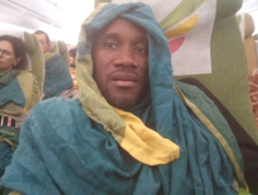
The Unique Mappers Network of Nigeria, are hosting their State of the Map: Nigeria Conference from October 11-14. Consider attending in-person in Nigeria or online. Letwin Pondo (pictured above) is representing SciStarter at the conference. Thank you, Letwin!